SPOTLIGHT: COMMUNITIES USING DATA TO DRIVE CHANGE ACROSS LONDON
Breathe London Community node data has allowed groups across London to access real evidence of air pollution in their areas. With this, they can present evidence to local councils to convince them to take essential action, making streets safer for families.
We’re diving into how our community groups have used Breathe London Communities node data to drive action in their local areas.
Green Our Neighbourhood Barnet
Using Breathe London Community node data to show evidence of high pollution around local schools, this group drove coordinated greening action, securing funding from local authorities to install new planting.
Green our Neighbourhood Barnet’s Breathe London Community Node
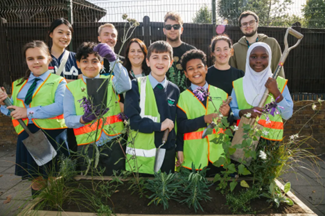
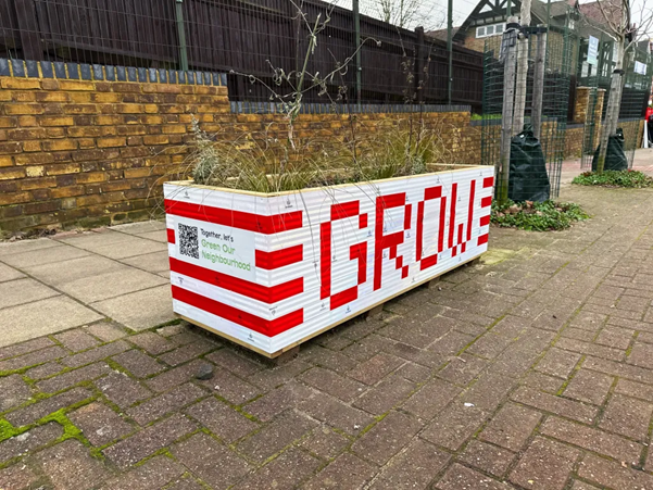
The new planting included hedging, sustainable drainage systems to trap pollution and wash it out with the rain, and green walls to provide barriers between schools and polluted air. The project helped build environmental awareness among children in the area and create a foundation for long-term air quality improvement measures.
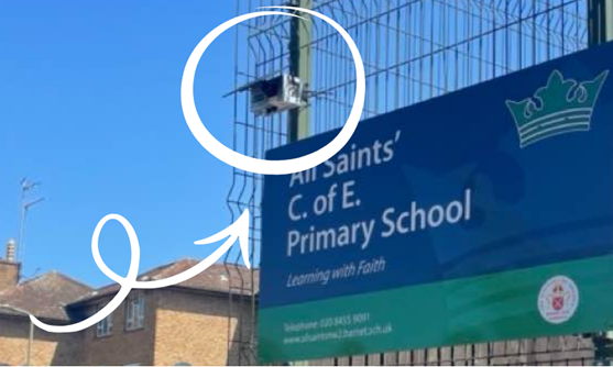
Rectory Road Residents’ Association
Based near one of East London’s busiest roads, they knew they had to take action to prove to local authorities that polluted air was impacting peoples’ quality of life. Rectory Road Residents’ Association have been proactive in using data to transform outcomes in their local area as one of the longest-standing community groups in our programme.
A local hospital saw over 800 children admitted in 2023 for breathing difficulties, highlighting the prevalence of air quality issues in the area, which Rectory Road Residents’ Association have campaigned to improve.
They developed an innovative app named AirMeter which converts air quality data from a local Breathe London Community node into visual augmented-reality effects, putting into perspective just how many particulates are in the air, and making air quality data as accessible as possible for residents.
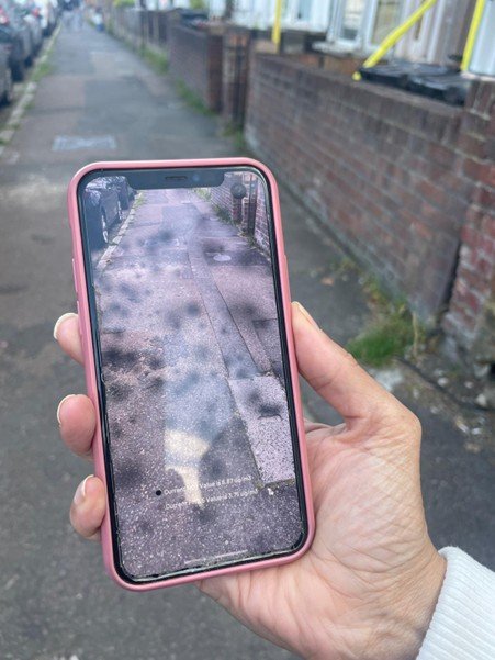
The AirMeter app shows pollution levels in the form of black spots on the screen.
This tool empowered the group, allowing them to present real-time data to councillors. A petition prayer by their local councillor Sem Moema was presented to the London Assembly.
The Association welcome discussion with other community groups interested in implementing this app (funding dependent). You can contact them by email: rectoryrdn16@gmail.com
Knitting the Air, based in Poplar, has taken an innovative approach to raising awareness of air quality data. They have transformed a year’s worth of Breathe London Community node data into a large-scale knitted art installation. The project brought together 130 knitters in the local area.
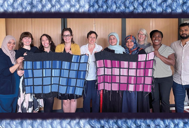
Knitting the Air has been recognised with multiple prestigious awards including a Global Women Inventors and Innovation Network Award and a Pineapples Award.
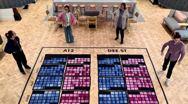
The project has toured across schools, GP surgeries, hospitals and community centres in Tower Hamlets and now they are raising funds for their first dedicated exhibition.
They have also recently secured funding from Arts Council England.
Find out more here.
Clean Air Bayswater are using Breathe London Community data to propose an ambitious plan: a green corridor running through West London.
This means that the previously heavily trafficked route between Westbourne Green Canalside and Hyde Park will be transformed into a safer, healthier and more walkable one. The greenery acts as a protective barrier to capture pollutants, reducing exposure for pedestrians. This green corridor is inspired by successful initiatives outside of London where urban greening has been implemented to mitigate pollution.
Other planned greening action includes creating green bus shelter roofs, erecting canopies, installing planters and creating living walls.
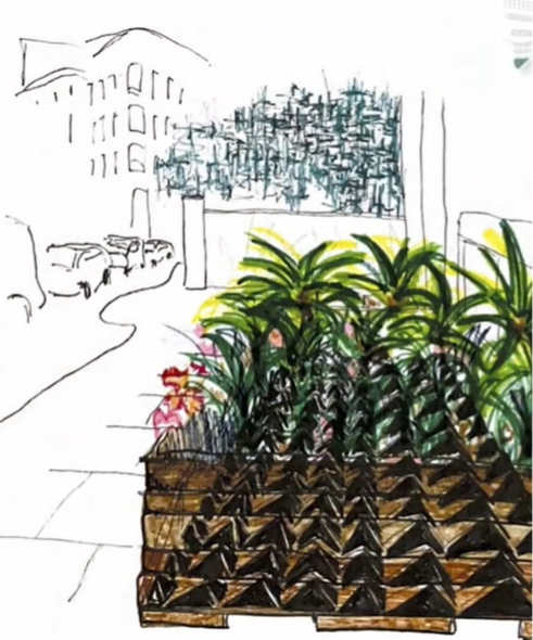
A planter
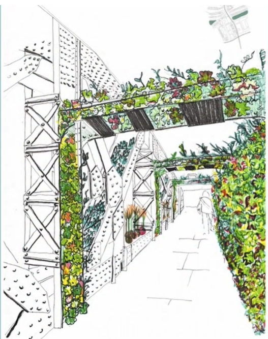
Canopies
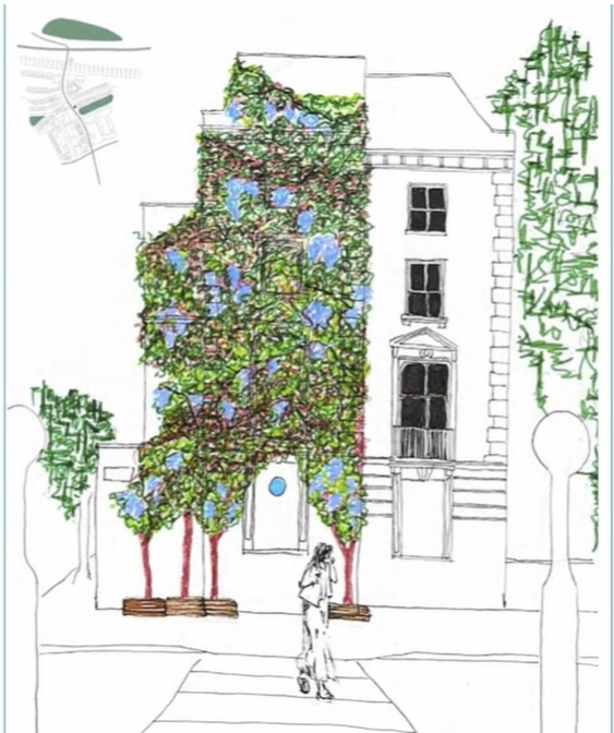
A living wall
The plan has been informed by input from residents and schoolchildren, ensuring that it meets the needs of the local community.
This project has inspired broader urban greening in the area, supporting cleaner air.
The group have secured early grants from Westminster City Council and Network Rail.
The Dulwich-based group Rosendale Clean Air were able to evolve into the award-winning charity Solve the School Run. Led by Nicola Pastore, this group uses Breathe London community node data to present hard evidence of the effect of school run car trips on local air quality.
Their recent campaign Streets for Kids calls on London councillors to implement 3 requests: an effective school street for every school, access to a cargo bike for every family, and introducing a dedicated strategy to make kerbsides safer for children.

They are active on social media which has ensured that their message is able to spread to a wide audience, alongside their frequent appearances in the national and local press.
Find them on X, Instagram and Facebook.
Friends of St James Primary School
Award-winning journalist Preeti Jha has been spearheading action in this community group by raising the profile of air quality issues in publications such as the New York Times. You can also find her on X and Instagram.
Friends of St James Primary School have been focusing on data, using a Breathe London Communities sensor to monitor air pollution near the school. Particulate matter in the air has been exacerbated by the construction of a large housing development nearby.
Their goal is to be considered for a school street by Haringey Council.
Breathe London data is open access: you can view data near you and even use it to campaign for measures in your area to improve air quality. If these stories resonated with you, we encourage you to get involved and register your interest in improving air quality to your local council.
Follow us on Instagram, X, and TikTok.
You can also contact us via email (breathelondon@imperial.ac.uk)